Skip to content

framingham.com (*** TEST SITE ***)

News and local information about Framingham, MA (USA)

  • Home
    • Welcome
    • Site Map
    • Newsletter Sign-up
  • Local
    • Framingham Calendar
    • Framingham Weather
    • Framingham History
    • Framingham Organizations
    • Maps u0026 Transportation
    • Framingham Books
    • Framingham Cable TV
    • Downtown Framingham
    • Framingham Heart Study
    • More Local Links…
  • News
    • Around Town
    • Arts / Culture
    • General Interest
    • Business
    • Health u0026 Fitness
    • Home u0026 Garden
    • Politics
    • Public Meetings
    • Schools u0026 Education
    • Seniors
    • Technology
  • Business
    • Business Directory
    • Shopping Guides
    • Shop Route 9
    • Shop Saxonville
    • Shop Downtown
    • Shop Nobscot
    • Real Estate Guide
    • Dining Guide
    • Coupons and Savings
    • Coupon Book
  • Schools
    • Schools/Education
    • Homework Help
    • FHS-TV
  • Living
    • Health u0026 Wellness
    • Kids Pages
    • Seniors
    • Recreation
    • Religion
    • Collector’s Corner
    • New England Travel
    • Sports
    • Ski New England
  • GOV
    • Town Government
    • State Government
    • Federal Government
  • Help
    • Ask framingham.com
    • Privacy Policy
    • Contact Us
    • Advertising Info
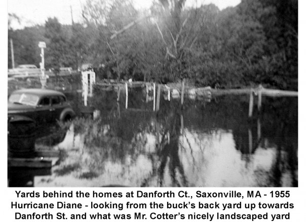
  • 1955 Hurricane Diane Floods Saxonville

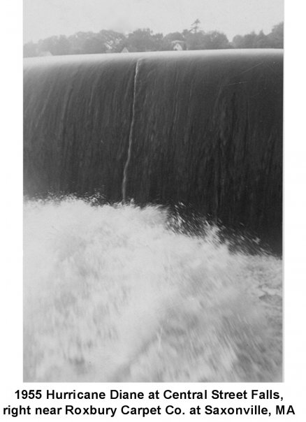
    The Great Falls at Saxonville, as water from 1955's Hurricane Diane pounds its way over the falls.
    The Great Falls at Saxonville, as water from 1955’s Hurricane Diane pounds its way over the falls.

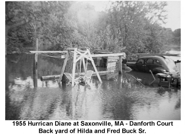
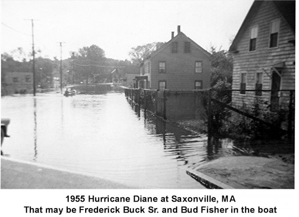
    FRAMINGHAM, MA — A preliminary report about hurricane DIANEĀ  from the U.S. Weather Bureau begins to tell the story of how more than a foot of water fell on Framingham one week during the summer of 1955.

    “Hurricane DIANE was first detected Over the Atlantic Ocean on August 11, 1955, about 400 miles northeast of San Juan, Puerto Rico. With winds of 50 to 60 mph over a small area near the center, DIANE moved in a northwesterly to northerly direction for about 24 hours. On August 12th, DIANE drifted slowly toward the north and northeast and increased in intensity to a full huricane, with winds of 115 mph near the center.”

    What the report only touches on, and the residents of Saxonville found out all too well, is the fact that DIANE hit the northeast on the heals of hurricane CONNIE, a storm which had hit 5 days earlier dumping 5″ – 10″ inches of rain in a single day.
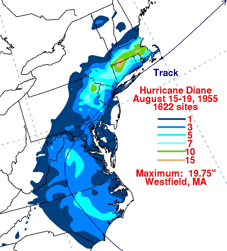
    Map showing Storm Track and Rainfall from Hurricane Diane, (Aug. 1955), U.S. National Oceanic and Atmospheric Administration (NOAA).
    Map showing Storm Track and Rainfall from Hurricane Diane, (Aug. 1955), U.S. National Oceanic and Atmospheric Administration (NOAA).


    News Staff

    April 2, 2010
    Around Town

Proudly Powered by WordPress