Skip to content

framingham.com (*** TEST SITE ***)

News and local information about Framingham, MA (USA)

  • Home
    • Welcome
    • Site Map
    • Newsletter Sign-up
  • Local
    • Framingham Calendar
    • Framingham Weather
    • Framingham History
    • Framingham Organizations
    • Maps u0026 Transportation
    • Framingham Books
    • Framingham Cable TV
    • Downtown Framingham
    • Framingham Heart Study
    • More Local Links…
  • News
    • Around Town
    • Arts / Culture
    • General Interest
    • Business
    • Health u0026 Fitness
    • Home u0026 Garden
    • Politics
    • Public Meetings
    • Schools u0026 Education
    • Seniors
    • Technology
  • Business
    • Business Directory
    • Shopping Guides
    • Shop Route 9
    • Shop Saxonville
    • Shop Downtown
    • Shop Nobscot
    • Real Estate Guide
    • Dining Guide
    • Coupons and Savings
    • Coupon Book
  • Schools
    • Schools/Education
    • Homework Help
    • FHS-TV
  • Living
    • Health u0026 Wellness
    • Kids Pages
    • Seniors
    • Recreation
    • Religion
    • Collector’s Corner
    • New England Travel
    • Sports
    • Ski New England
  • GOV
    • Town Government
    • State Government
    • Federal Government
  • Help
    • Ask framingham.com
    • Privacy Policy
    • Contact Us
    • Advertising Info
  • Water Level Lowered in Stearns Reservoir, (Framingham Reservoir #1)

    Water Level Lowered in Stearns Reservoir, (Framingham Reservoir #1)

    FRAMINGHAM, MA — Beginning in early October (2021) and continuing for approximately four to six weeks, the Massachusetts Department of Conservation and Recreation (DCR) and the Massachusetts Water Resources Authority
    (MWRA) will commence a drawdown of Framingham Reservoir No. 1, (also known as Stearns Reservoir.

    The water level is being lowered to accommodate work on a new operations and emergency-use only boat ramp located at Salem End Road.
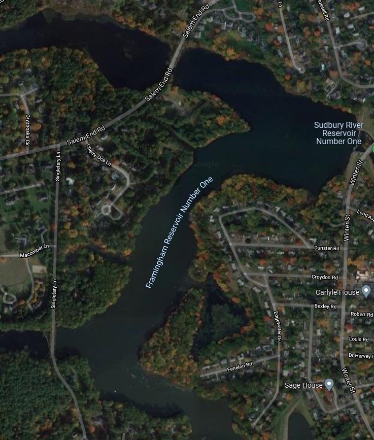
    Framingham’s Reservoir No. 1 is located roughly between Badger Road and Winter Street to the east and west, and by Worcester Road (Route 9), and Waverley Street (Rt. 135) to the north and south.

    Residents should can expect a significant drop in the water levels of the reservoir for an extended period of time. The drawdown and lowered water levels are expected to last until early to mid-November.

    For further information, contact: Department of Conservation and Recreation (DCR) and the Massachusetts, Olivia Dorrance, phone: (617) 626-4967, or email to: Olivia.K.Dorrance@mass.gov

    ###

    News Staff

    October 12, 2021
    General Interest
    boat launch, boat ramp, mwra, reservoir #1, Salem End Road, stearns reservoir

Proudly Powered by WordPress